ROLE Data visualizer, Sculptor
DURATION 2 months
TECHNOLOGY Trotec Laser Cutter, Illustrator, Excel, Etching
AWARD Communication Arts feature
DURATION 2 months
TECHNOLOGY Trotec Laser Cutter, Illustrator, Excel, Etching
AWARD Communication Arts feature
Context:
My goal for this project was to develop a structure that manipulates our perception of time. I approached my subject area by asking myself: how can the physical structure inform pacing? What kind of structure might lend itself to juxtaposing time lines or different perceptions of time?
My goal for this project was to develop a structure that manipulates our perception of time. I approached my subject area by asking myself: how can the physical structure inform pacing? What kind of structure might lend itself to juxtaposing time lines or different perceptions of time?
I first came across the content matter when researching Chicago street names – ancient trails and trade routes are hidden all throughout Chicago's grid system. Many of the city’s roads began as indigenous pathways – just one example of Native American infrastructure that helped make Chicago a successful city. The Chicago area is located on ancestral lands of indigenous tribes, such as the Council of the Three Fires--comprised of the Ojibwe, Odawa, and Potawatomi Nations--as well as the Miami, Ho-Chunk, Menominee, Sac, Fox, Kickapoo, and Illinois Nations.
Background research:
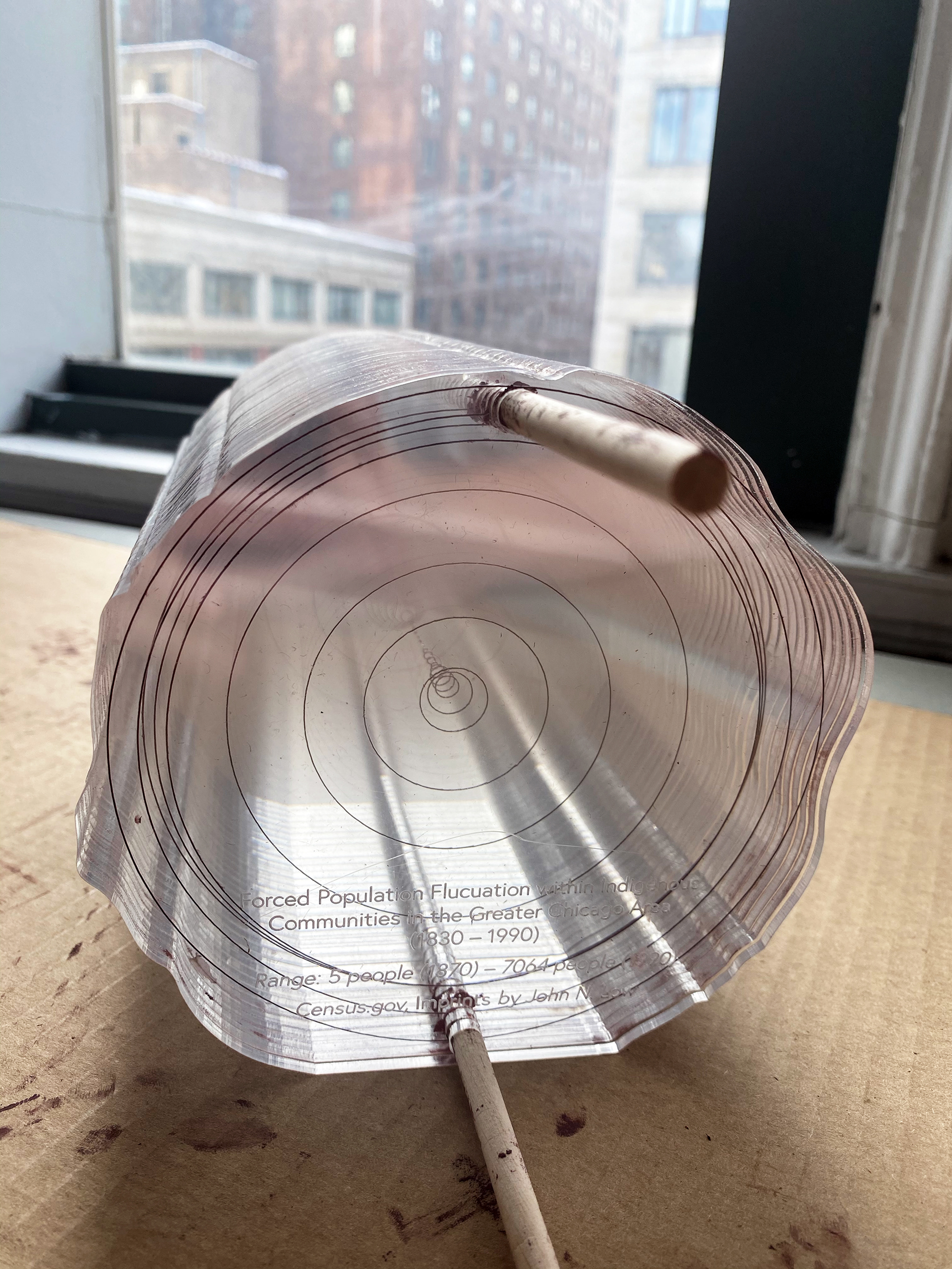
In compiling a data set recording the forced population fluctuation within indigenous communities in the greater Chicago area between 1830 and 1990, two moments in time stood out. In 1870, post European contact and subsequent to the Treaty of Chicago (1833), only five Native Americans remained in Chicago after tribes native to the area were driven out of the land they had inhabited for thousands of years. In the early 1900s, these same communities were forced back into the city, culminated by the Indian Relocation Act of 1956, the objective being "total assimilation" and erasure of traditional indigenous values.
Creative Direction:
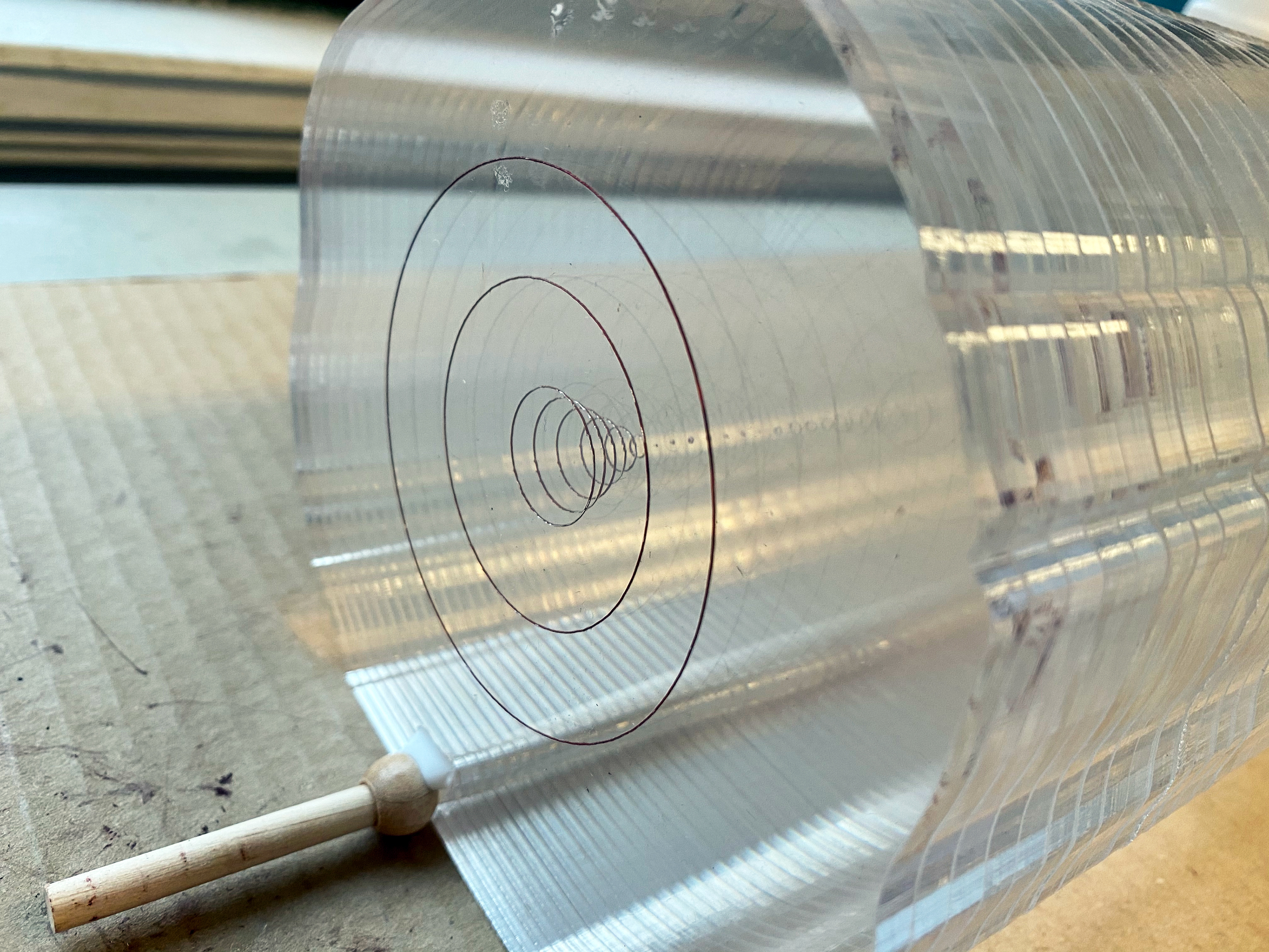
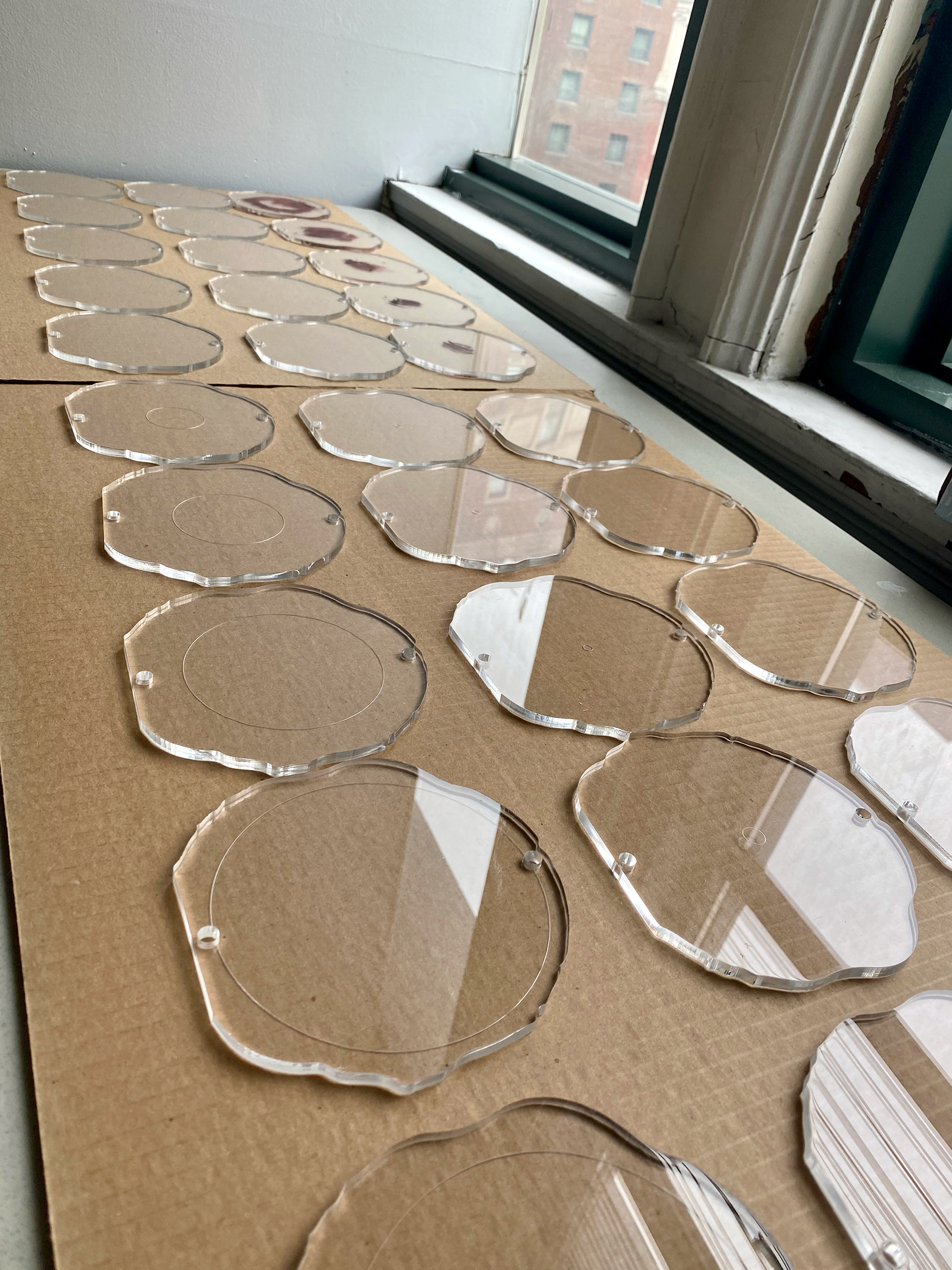
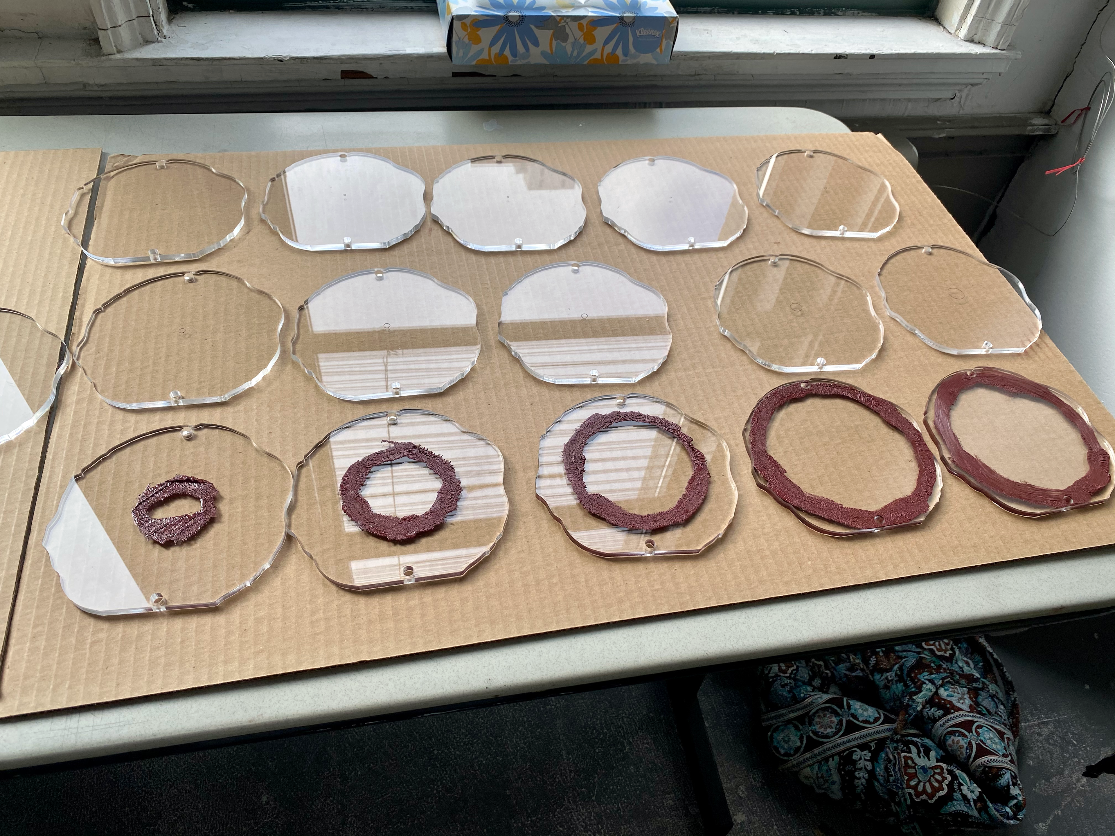
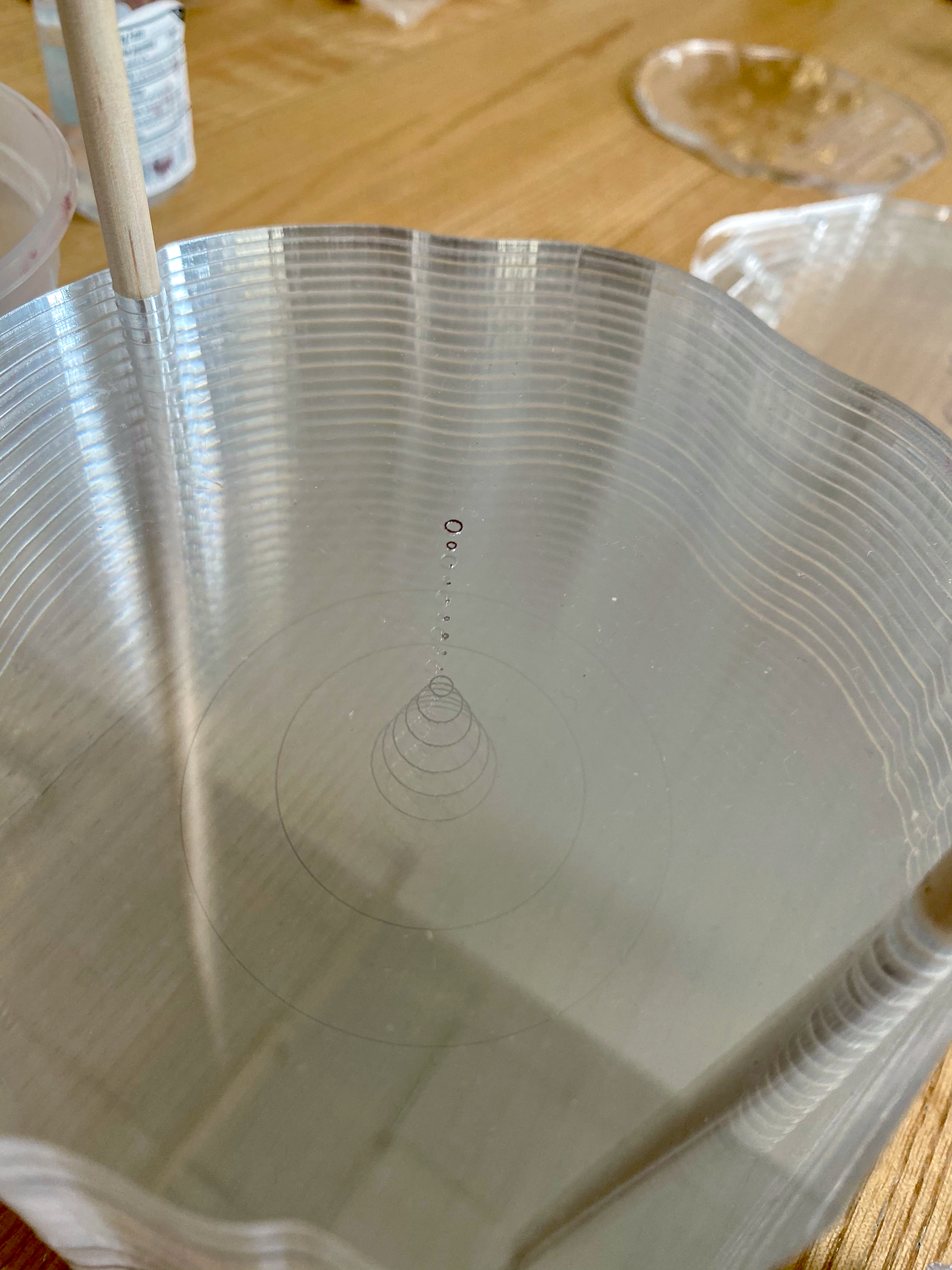
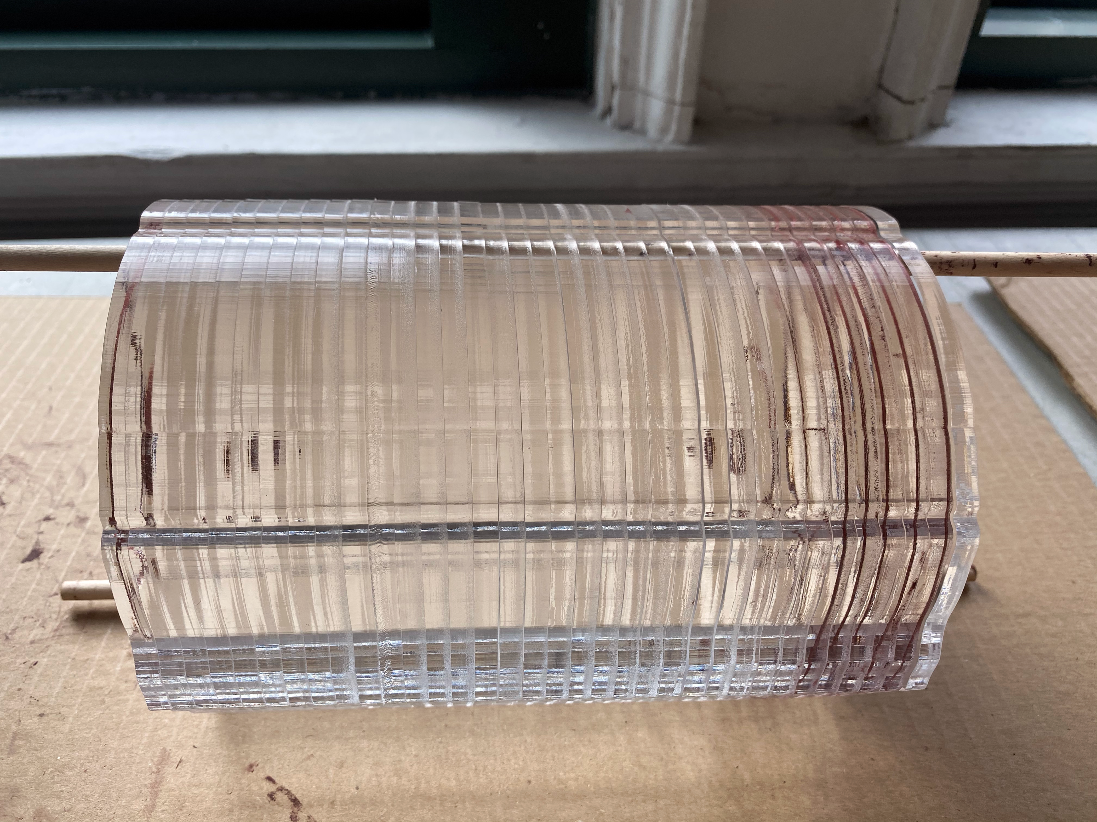
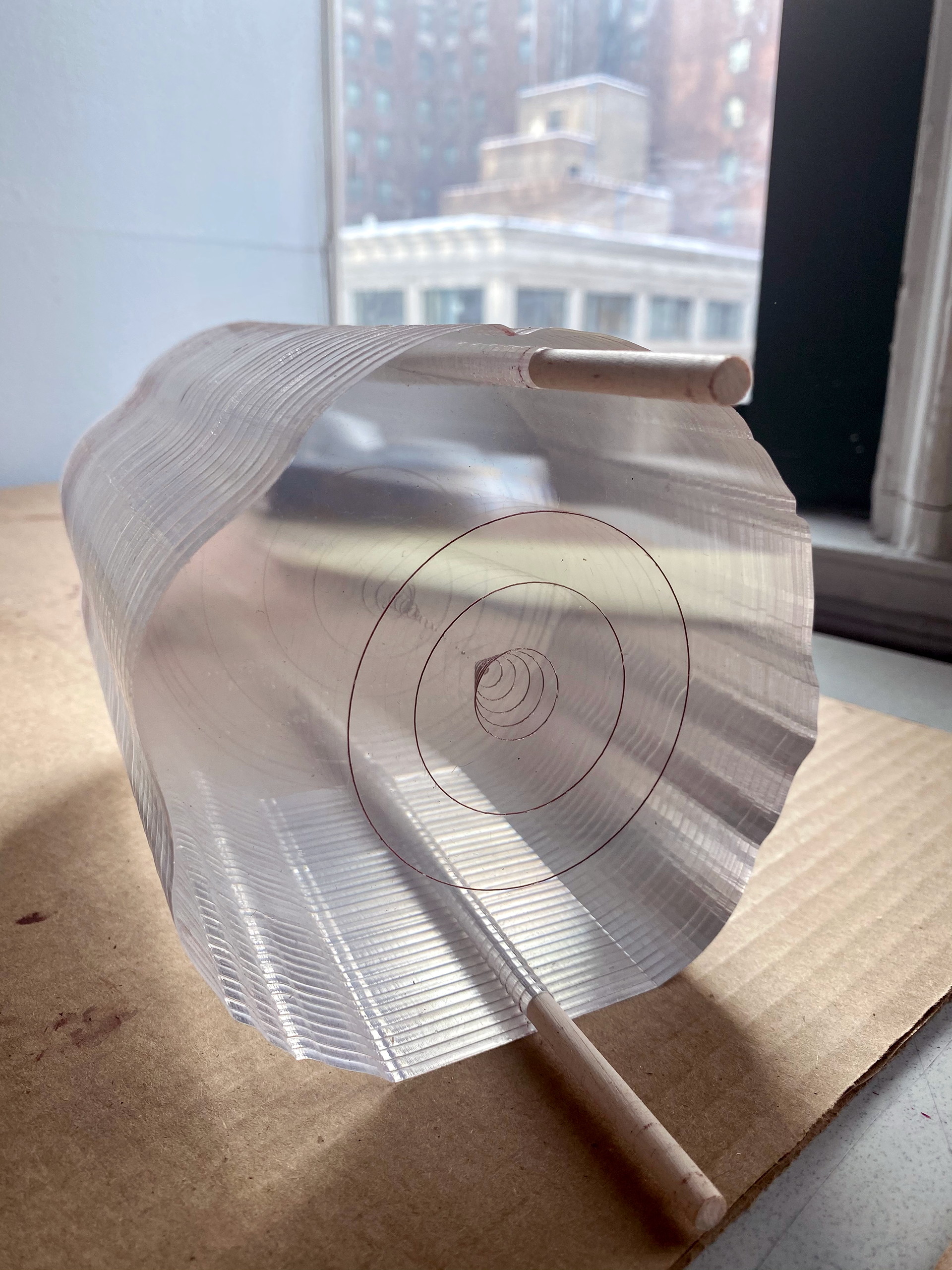
Dendrochronology, or the science of dating tree rings, inspired how I went about telling the story behind this data set. I learned as a child that the age of a tree could be determined by counting its rings. I began by laser-printing several "layers" of an organic shape mimicking that of a tree trunk – each layer represented a five-year interval.
I then etched circles onto each of the layers, the area of which corresponded with the estimated number of Native Americans living in the greater Chicago area at that time. The shape created by stacking the layers on top of one another simulates that of an hour glass. It is my intention that the final product serve as a reminder of the fact that we reside on occupied land.